Top 5 Mountains in Colorado
Peak Mountains in Colorado’s Rockies
With more than 5,000 individual mountains, it wasn’t easy creating a list of the top 5 mountains in Colorado. Just narrowing the list down to mountains of 14,000 feet (4267 meters) still left us with 58 peaks to choose from! Ultimately, we decided to select the most iconic, beloved and popular peaks, the mountains that make us rise before dawn to climb to the summit or gather up out-of-town visitors to show off just how beautiful Colorado can be from the viewpoint of an eagle flying in the sky. Whether you manage to visit one or all of these peaks, we hope this list will help you maximize the fun on your adventure.
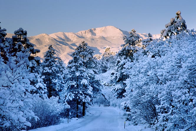
Pikes Peak — America’s Mountain
- Paid Entry
- Accessible by Car
- Visitor Center
- Hiking
- Fishing
- Scenic
Directions: Take Highway 24 west out of Manitou Springs. Head west for about 9 miles (14.5 km), paying attention to directional signage. Turn left onto Fountain Avenue near Cascade and proceed to the entry gate.
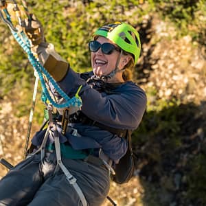
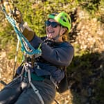
There are a lot of reasons why Pikes Peak is a favorite on our list of top mountains in Colorado. Let’s start with the fact that Pikes Peak is one of the most accessible mountains when it comes to reaching the summit. We would argue it is the most accessible mountain on this list. You can drive to the top. Hike to the top. Take a train to the top. You can take a shuttle or a Jeep to the top. If the weather is decent and the roads are clear, you’ll summit that mountain.
Getting Up Pikes Peak
Earlier, we mentioned there were several ways to get to the top of Pikes Peak. Let’s look at those a little more closely. The first, easiest, and most affordable is to drive to the top. The Pikes Peak Highway is a 19-mile stretch of road that curves from the base of the mountain next to The North Pole — Santa‘s Workshop, and goes all the way through every life zone on the mountain until you reach the summit. There are plenty of places to stop and pull over and take photos, and if you get the handy map provided when you go through the gate, you’ll be able to use that map to guide yourself and learn about the flora and fauna as you go.
Taking the Pikes Peak Cog Railway
If you prefer not to drive, the Pikes Peak Cog Railway takes you from the station in Manitou Springs next to the Iron Springs Chateau, all the way to the summit. You’ll get to see a side of Pikes Peak that most people have to hike to explore. You’ll get treated to an entertaining series of information about the peak as you climb. Once you’re at the top, you get time to walk around and check out the views.
The Pikes Peak Summit Visitor Center
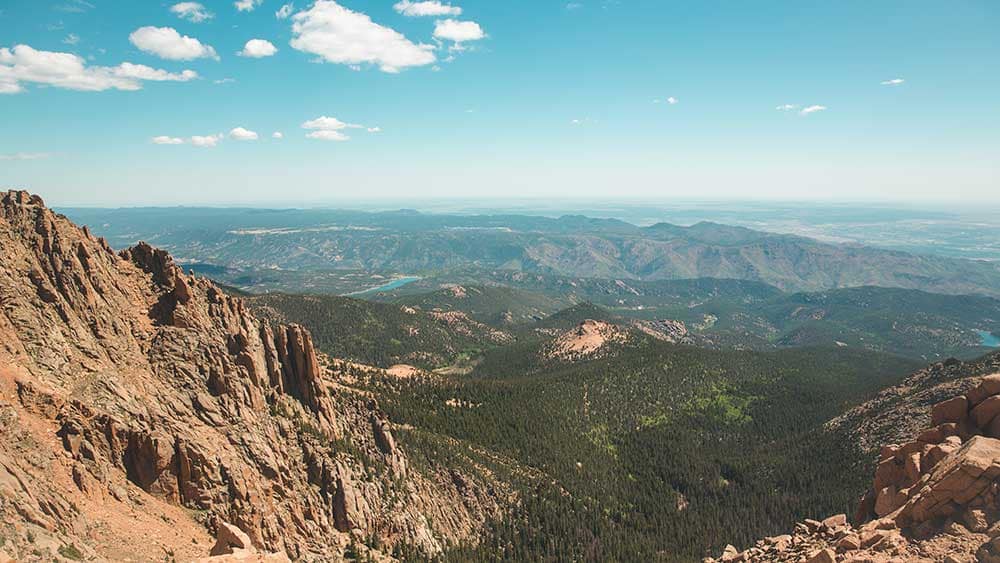
Pikes Peak is also pretty special because of the fantastic Summit Visitor Center at the top. Remodeled in 2021, this brand-new structure is huge, with giant windows overlooking the stunning Colorado panorama. There are interactive educational displays, a giant gift shop and did we mention the hot and fresh donuts? Pikes Peak is home to a special type of donut with a recipe designed to rise at high elevation, where there is very little oxygen. A donut is already a magical thing but a donut that was developed to thrive at the top of the world is something else entirely. Make sure you grab yourself a batch while you’re there.
Outside of the visitor center, an interpretive walking path takes you around the top of the mountain, allowing you to access views of all points of Colorado and beyond. On a good day, you can see five states. It’s best to go in the morning if you’re trying to accomplish that goal. It can get cloudy by the afternoon. Then the train takes you back down to the base, where you can spend the rest of your time exploring Manitou Springs. Remember to pay for parking. The Pikes Peak Tour by Gray Line is also a great option for getting chauffeured up the Pikes Peak Highway. Their coaches have comfy seats, huge windows and climate control!
Hiking Pikes Peak
The final method, and definitely the most difficult, is to hike Pikes Peak. There is more than one way to hike up the mountain, but the most common is using Barr Trail (the down route for the Manitou Incline). You’ll take that all the way up to the top and celebrate your stunning feat of excellence. We have a whole guide for preparing to hike Pikes Peak. We do not recommend it unless you are in great physical condition and experienced in hiking at altitude.
Mount Blue Sky (FKA Mount Evans)
- Paid Entry
- Accessible by Car
- Visitor Center
- Hiking
- Fishing
- Scenic
Directions: From Idaho Springs, take CO-103 S (use exit 240 if traveling on I-70) for about 13 miles (20.9 km), then turn right onto CO-5 S and continue along the route. If you are traveling through 2026, you will have to stop and park below the summit.
Introducing the home of the highest paved road in North America! Mount Blue Sky is located in the Mount Evans Wilderness area (after the mountain’s former name). The mountain’s name comes from the Cheyenne and Arapaho and has connections to the heritage of both. Dozens of other indigenous groups also have ties to the mountain. It’s the highest peak in that wilderness area and it has a commanding presence both from a distance and on the trail. You will be surrounded by alpine lakes, unique wildlife and the unearthly beauty of life above the treeline. And if you love wildflowers, wildflowers you shall have. It is stunning and it’s worth at least one visit!
At 14,130 feet in elevation (4,307 meters), Mount Blue Sky is just a bit taller than Pikes Peak. Unlike Pikes Peak, however, you cannot summit Mount Blue Sky by car through Memorial Day of 2026. Mount Blue Sky Highway is closed to everything — hiking, biking, and especially motor vehicle traffic. The bright side is that the road will be updated and much safer. The downside is that the summit is only accessible to hikers. If you noted our advisory about hiking Pikes Peak, then you know that’s not easy to jaunt up a 14,000-foot mountain. Let’s look at how to tackle Mount Blue Sky, including by car (when the highway opens again).
Hiking Mount Blue Sky
Mount Blue Sky is not an easy hike. Of the 11 routes 14ers.com has posted, more than half are Class 3 difficulty. That sounds intermediate, but it’s important to remember that they aren’t just talking about your endurance or athleticism. They are also referring to your experience. Per their website, a Class 3 means, “Scrambling or un-roped climbing. You must use your hands most of the time to hold the terrain or find your route. This may be caused by a combination of steepness and extreme terrain (large rocks or steep snow).” More than half of the routes also have high or difficult risk factors like risk of falling, navigation or the inability to easily quit and return to safety. None of that considers the impact of elevation on your body. The lack of oxygen is more than a bit draining!
The shortest route with the least elevation gain is West Ridge from Summit Lake. It’s considered a Class 2. Fortunately, that route is still accessible even with construction. You will have to pay a fee and pre-register to use the area. It gets extremely busy in the summer and you will find parking difficult, even with a pass, even with construction and closures. People in Colorado and people visiting Colorado love to hike and Mount Blue Sky is very popular.
The trail is about 5.5 miles (nearly 9 km), but it’s not an easy distance. You start at over 12,000 feet (3657 meters) and gain 2,000 feet in elevation (600 meters). You should be experienced at high-altitude hiking, able to read cairns and directional signage and have proper food, water and gear before you set out. Bring adequate water and water filtration. If any of this sounds unfamiliar, please do not attempt the hike.
Driving Mount Blue Sky
Driving to the top of Mount Blue Sky is considerably easier. You pre-register online and book your timed entry up to 30 days in advance. The Forest Service releases tickets daily, on a rolling basis, rather than all at once. That means you have a way better chance of getting your ideal entry time. They also release a smaller number of reservations two days in advance — don’t count on those, though!
Mount Blue Sky Scenic Byway is 28 miles long from its start in Idaho Springs. The route is paved and does not require AWD or any special vehicle modifications. There are lots of places to stop along the route, so don’t weave all over the road trying to take in the sights. Pull over and take your time. Get those photos! Pioneers had to spend days getting to a summit that takes you two hours (with AC). Be sure to look out for marmots, mountain goats and other wildlife as you ascend.
.
Maroon Bells
- Paid Entry
- Hiking
- Fishing
- Scenic
- Camping
Directions: From Aspen, take CO-82 E. Take the second exit in the roundabout and follow Maroon Creek Road for about 10 miles (16.1 km). You will be able to follow directional signage to the parking area. Remember to make reservations before you go between May and October.
The Maroon Bells are a pair of fourteeners located just outside Aspen and Snowmass, about 5 hours from Colorado Springs and under 4 hours from Denver. The pair of picturesque mountains is framed with beauty in every direction, from the clear, blue Colorado sky above to the sweeping glacial valley and pristine lake that surround the base. Named for the unique purplish color of the predominant mudstone that forms them, as well as their round “bell” shape, it’s clear why newspapers, travel websites, and travel writers frequently tout the Maroon Bells as the most photographed mountains in Colorado. Once you check out the snapshots of a fall leaf adventure or a spring wildflower awakening, you’ll become a photographer, too.
Can I Summit the Maroon Bells in a Car?
Unfortunately, the summits of these gorgeous mountains, Maroon Peak and North Maroon Peak, are not accessible by car, train or shuttle bus. If you are not an experienced hiker, your journey to view these peaks stops in the Maroon Bells Scenic Area. However, you will find your journey was worth it, summit or not. There is plenty of stuff to so — we promise.
How Do I Get to the Maroon Bells Scenic Area?
Like many other popular destinations in Colorado, the Maroon Bells Scenic Area has transitioned to a timed-entry, registration system during the peak season. Peak season begins around Memorial Day and continues through mid-October. This ensures you’re not maneuvering along packed hiking trails trying not to destroy the natural environment. It also means you don’t have to spend hours in line in your car waiting for a chance to get through the gates.
Before you get in your car and drive, plan ahead and schedule your entry time. You will have a better chance of securing your ideal time if you check out the registration process online now. You will be asked to choose between parking at the trailhead or reserving a shuttle bus ride. Parking at the trailhead is available only before 8 a.m. for visitors looking to hit the trails early. After 8 a.m., the road is closed, and only a shuttle is available. You can still leave, but you can’t come back.
The cost to park or ride the shuttle will vary. The cost to park is much lower than the shuttle, which charges per car rather than per person. Campers can book overnight parking for longer hikes/overnights. Most people will need to take the shuttles. On the plus side, the shuttle allows leashed, well-behaved dogs to ride along.
Hiking Maroon Bells
There are multiple hiking trails available for day hikes or for backpacking that do not involve summiting Maroon Peak. The Crater Lake Trail is a 3.5-mile hike that sounds short, but it will challenge you at altitude.
Climbing to the summit is not for amateurs. We think 14ers.com says it best: “Maroon Peak is one of the most difficult of the standard 14er routes; it’s long, tedious, and dangerous. Don’t take it lightly, don’t go if you don’t have solid Class 3 climb skills, and don’t go just to check this mountain off your list.” It is 12 miles round-trip from the trailhead to the summit. You will climb nearly 5,000 feet in elevation. The weather can be volatile in every season, the trails can be hard to find, and mistakes can cost you the price of a search and rescue trip — if you are lucky enough to survive them!
Maroon Bells Activities
Okay, so you’ve realized you’re probably not going to the top of Mount Maroon. You’ve also realized most of the rest of us won’t be going up either. Fortunately, the wilderness area still has plenty of hiking (see the aforementioned Crater Lake Trail). For an easy and short hike (about a mile), simply walk around the lake!
You can also fish in Maroon Lake and along Maroon Creek, camp, picnic, take a lot of photos, and generally enjoy your day. Be sure to check for camping restrictions, especially near bodies of water. You may also need to obtain an overnight wilderness permit.
Mount Elbert
- Hiking
- Scenic
- Camping
- Fishing
Directions: Take Highway 24 west out of Colorado Springs and travel for about 124 miles toward Leadville. Just before Leadville, make a left turn onto CO-300 W. After about a mile, turn left onto Halfmoon Creek Road and travel 5 miles to the trailhead. Please note that Halfmoon Creek Road is a dirt road that may have ruts, washboard, and exposed rock. While many vehicles can make the drive, conditions can be adverse at times.
We’ve now reached the tallest mountain in the state of Colorado, making it worthy of our list of peak peaks. Towering over all the other mountains around at 14,438 feet (4,396 meters), Mount Elbert is located near Leadville in the Sawatch Range. It’s impressive, with a blanket of snow at the summit that can last even into the hottest days of summer. We would call it massive, but the mountain next to it already has the name (for its whopping 5 summits). You cannot drive to the summit, nor is there a nifty wilderness area to hang out and enjoy the view. You’ll want to check out Twin Lakes for that. If you want to reach the summit, you’ll have to do it on foot.
Hiking to the Top of Mount Elbert
Mount Elbert is warmly referred to as a “gentle giant” when compared to other 14,000-foot mountains in Colorado. Erosion has worn this mighty mountain down to a much more traversable adventure than many of its shorter counterparts, particularly the Northeast Ridge Route. The route has made the top 10 for “easiest” fourteeners. That’s good news for experienced hikers with strong fitness and high-altitude hiking experience! It is considered a Class 1 peak with low difficulty, easy route-finding, and low commitment.
That being said … you are still navigating these easier trails at very high altitude. You will hike over 9 miles out and back, gaining 4,500 feet in elevation. With very little oxygen, the closer you get to the summit, the slower and more tired your body will become. It is important that you don’t just hop on the trail without planning for water, weather, sun exposure and daylight.
Things to Remember
Start your hike as early in the day as possible to account for afternoon thunderstorms. The higher you are, the more danger you are in with regard to lightning strikes. The cool thing about Mount Elbert (and neighboring Mount Massive) is that there is ample camping along the road to the trailhead. That means that you can stay overnight and get an early head start on your hike. It also means you can have a hot meal and a place to rest nearly immediately after completing your hike. Arrive early in the afternoon to try to secure an ideal campsite closer to the trailhead. Finding the trailhead is easy. Simply follow Halfmoon Creek Road for about 5 miles. You’ll know you’re close when you can’t find a place to park and you have to turn back and find a spot further away.
Which brings us to the drawbacks of an easy-to-find, easier-to-hike mountain — crowding. There are no permits for hiking to the summit and once you arrive, you may be more grateful for ticketing/timed entry at other popular places in the future. It’s one of the most popular mountains in Colorado and you’ll know it from the drive to the trailhead. A lot of people can climb this mountain, and a lot of those people want to. The better the weather, the more people you’ll be hiking with on the trail. Be prepared, be kind and be patient. You’re all in this together!
Long’s Peak
- Hiking
- Scenic
- Camping
- Paid Entry
Directions:
Long’s Peak’s claim to fame is that it is the only fourteener in Rocky Mountain National Park. That’s pretty amazing considering there are 77 mountains over 12,000 feet in the park’s 415 square miles! But that’s not all that makes this mountain one of the best peaks in Colorado. It’s also home to an alpine glacier. Not many mountains in Colorado have glaciers these days. Only about a dozen are even named. Long’s Peak’s resident glacier is known as Mill’s Glacier.
Glaciologists would argue that Mill’s is no longer a real glacier due to its shrinking mass and the lack of ice flow, but it is still pretty cool. And did we mention Long’s Peak is even noteworthy enough for a mention in a Jules Vern book, From the Earth to the Moon? The mountain is home to an observatory used to track a group of weapons fanatics as they attempt to build a space fun and launch themselves to the moon (we didn’t say it was a good book).
Is it easy to climb Long’s Peak?
In a word? No. Of all the peaks on this list, Long’s Peak is the hardest and most dangerous. It’s also the mountain in Colorado with the highest number of deaths. Only half of the mountaineers who make the attempt will reach the summit. Most have to turn back due to weather, lack of gear, lack of experience, exposure, or injury. In 2010, the Estes Park Trail Gazette reported that there was an average of one death per year on Long’s Peak. All routes ascend over 5,000 feet in elevation, and the shortest route is 13 miles. The standard route is 14.5 miles and includes The Narrows, which should be enough to deter even the most optimistic amateur hiker. Here’s a video of that tricky little section of trail. Don’t watch if you have vertigo or a fear of heights.
How Can Non-Mountaineers Enjoy Long’s Peak?
The easy way to enjoy Long’s Peak is a day in Rocky Mountain National Park. You will need to register for a timed entry to the park in advance. Once you’re in, you’ll have a variety of ways to check out the mountain. If you want to get up close without holding onto the side of a cliff, you can take the Chasm Lake Trail. This is a challenging route, but it maxes out at 8 miles round-trip with an ascent of about 2,500 feet.
Trail Ridge Road is decidedly further than Chasm Lake Trail, but it offers excellent views of Long’s Peak. The road is dirt and will require you and your fellow drivers to be extra polite and follow right-of-way rules in narrow spots, but it’s generally in good condition. Another bonus to this route is that you may see moose along the drive. Stay in your car and leave them alone. They are not friendly.
The least strenuous driving route to view Long’s Peak is the Peak to Peak Scenic Byway. This route takes about 1.5 hours and covers 55 miles between Blackhawk and Estes Park along the Continental Divide. Of course, you’ll probably take way longer than 90 minutes, considering all the stops you’ll want to make to take photos. Consider taking some of the free buses that run through the area if you’d like to make the drive even easier. There are several routes between mountain towns that you can turn into a scenic ride.
You can also see the view of Long’s Peak from this handy park webcam. It offers a spectacular view — unless it’s snowing, of course.
Which Peak is Your Favorite?
From accessible and easy to technical and difficult, these top mountains in Colorado offer every experience imaginable when it comes to exploring the Rocky Mountains. We hope you’ll find your own favorite peak as you travel the Centennial State, whether it’s one on the list or one you find along the way.
about the author