Manitou Incline
A step-by-step guide to conquering the 2,744-step hike
Top things you need to know
Reservations required
A free online reservation is required and must be shown to the onsite attendant before hiking. Book your time slot at least a few days ahead, especially for weekend climbs. The reservation system helps manage traffic on one of Colorado’s most popular (and most punishing) trails.
Plan for parking and shuttle time
Parking fills up fast, especially on weekends. The closest lots are in Manitou Springs, with free shuttles running every 20 minutes to get you to the trailhead. Factor in 30-45 minutes for parking, shuttling, and walking to the base before your reserved time slot.
Start early in the day
Morning starts give you the best weather window. Colorado’s afternoon thunderstorms are no joke, especially when you’re exposed on a mountainside. Summer lightning storms typically build after 2 p.m., so aim to finish your climb before early afternoon.
Don't make this your first Colorado hike
If you haven’t been hiking at altitude before, the Incline is not the place to start. Seriously. First responders can take 3-4 hours to reach someone in distress on the trail. Build up your altitude conditioning and fitness on easier trails first — your body (and the first responders) will thank you.
What is the Manitou Incline?
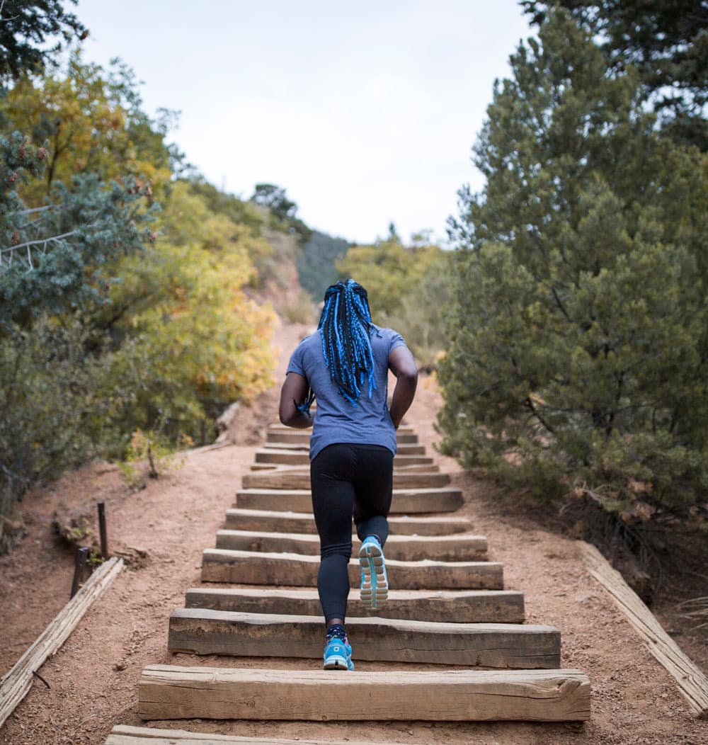
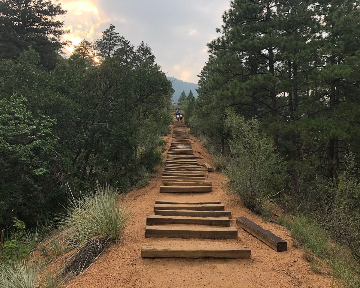
The Manitou Incline has earned its reputation as the holy grail of cardio for locals and visiting athletes alike. What was once a railroad track now consists of approximately 2,744 steps made entirely of railroad ties. Yes, you read that right — 2,744 steps.
Here’s what you’re signing up for: just one mile in length, but with an average 41% incline (hitting 68% at its steepest) and a 2,000-foot elevation gain. That’s more stairs than the Empire State Building, except these stairs go up a mountain. The Manitou Incline ranks as one of the highest sets of stairs in the world, and this trail is rated Extreme for good reason.
Think you’ve got what it takes? Here are the tips that’ll help you make it to the top.
Tips from your Local Guides
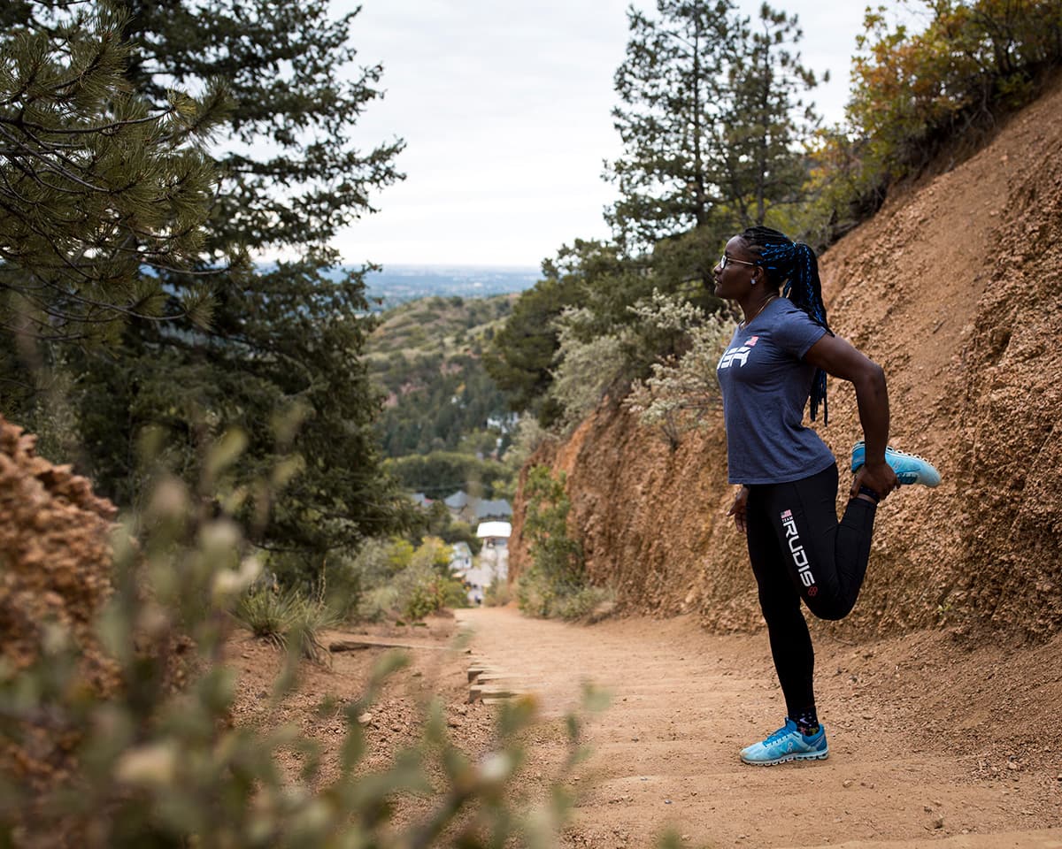
Pace yourself
Pace yourself
Slow and steady wins this race. Start at a pace that feels almost embarrassingly slow — we’re talking tortoise-level commitment here. You’ll watch people sprint past you in the first few minutes, and that’s fine. They’ll be gasping at the false summit while you’re still moving. The Incline humbles everyone eventually, so save your energy for the long game.
Hydrate & Breathe
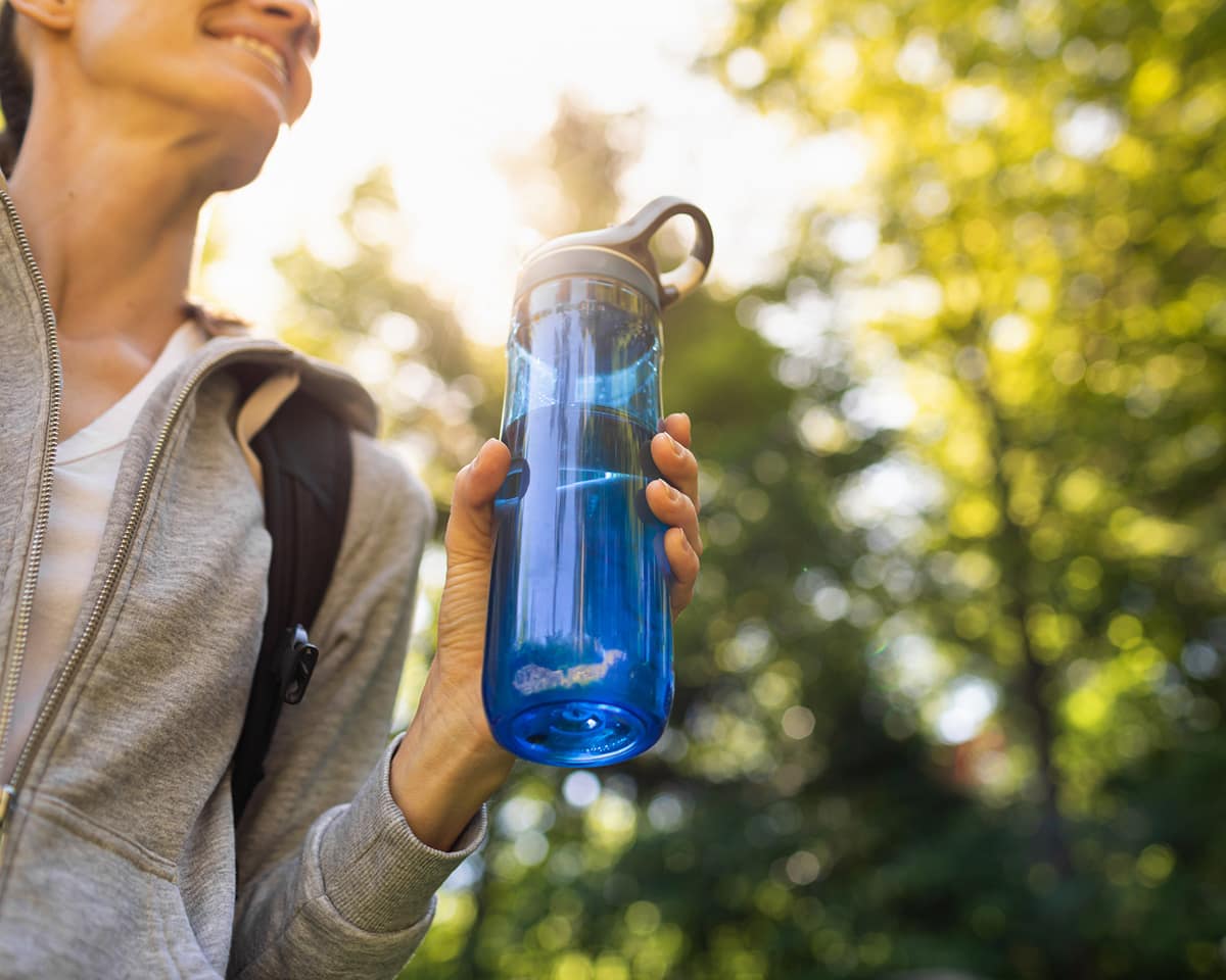
Hydrate & Breathe
You’re going to sweat. A lot. Bring water — this is non-negotiable. Pace your drinking and make it last the entire climb.
Your breathing matters just as much as your hydration. You’re ascending 2,000 feet while exerting yourself at an expert level in thinner air. Monitor your breathing the entire way up. Finding a rhythm with your breath helps regulate oxygen intake, keeps you moving steadily, and distracts you from the fact that your legs are staging a protest.
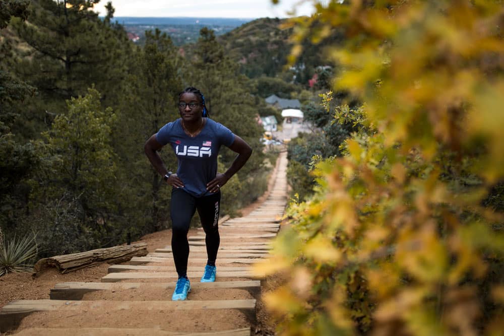
Bailout Points
Bailout Points
This trail means business, and altitude affects everyone differently. There’s zero shame in turning around — listen to your body. The Incline now has multiple return options:
-
At railroad tie 395: Connect to Ute Pass trail for a quick ⅓ mile back to the trailhead.
-
At railroad tie 1,300 (roughly halfway): Connect again to Ute Pass trail for a 1.5-mile hike back to the base.
-
About 500 steps beyond that: The original bailout point connects to Barr Trail.
Take a Break... or Two... or Six
Take a Break... or Two... or Six
Most people stop multiple times on the way up — there’s no prize for doing this without pausing. When you need a breather, try not to sit all the way down. Lean against the railing instead. This keeps your heart rate elevated enough that you don’t lose all your momentum when you start moving again.
And hey, while you’re catching your breath, turn around. The view keeps getting better with every step.
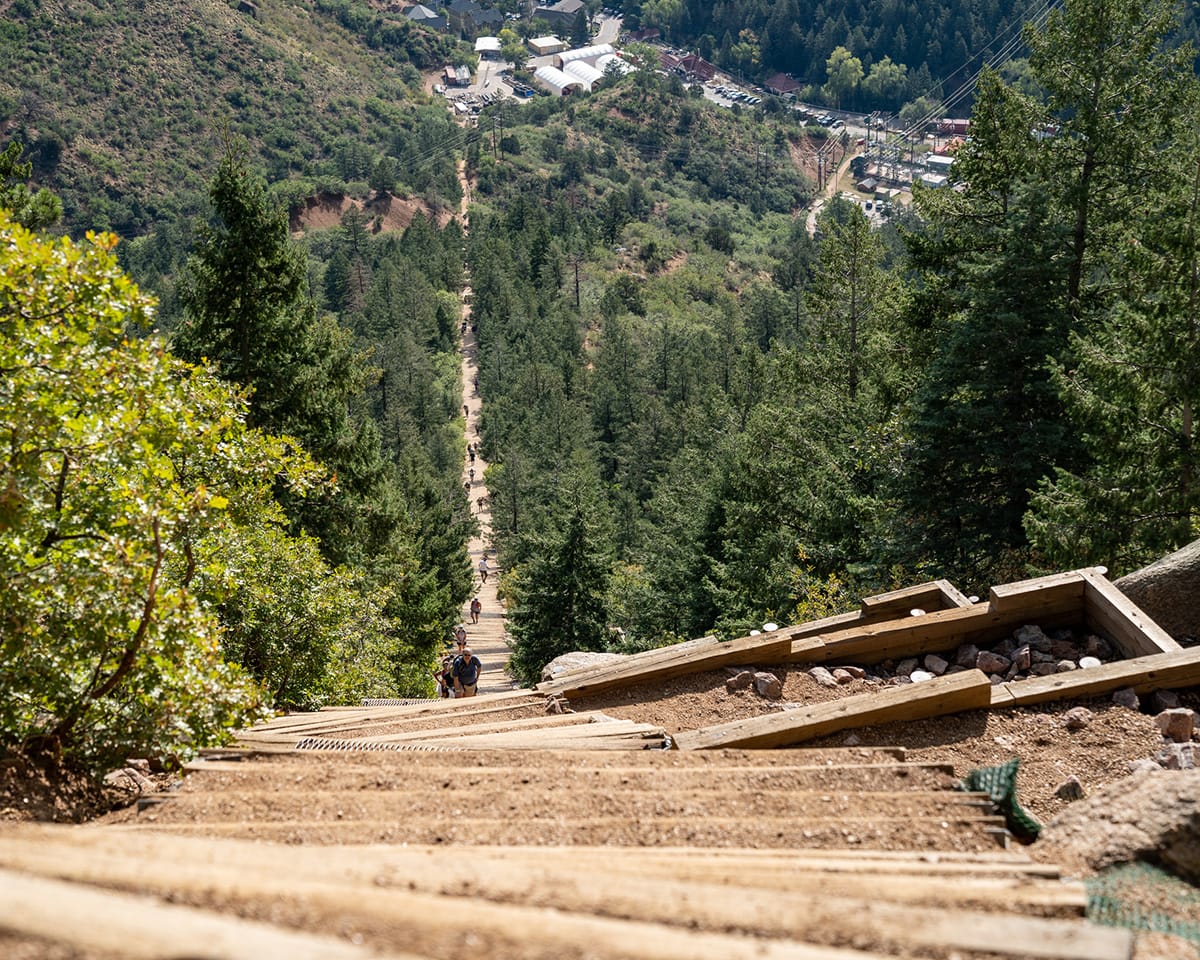
Beware the False Summit
Beware the False Summit
Eventually, you’ll see what looks like the top. Your brain will start celebrating. Your legs will feel hopeful.
Bad news: that’s the false summit, and you’ve still got about 300 steps to go.
Good news: once you pass that point, the most challenging and dangerous stretch is behind you. You’re very, very close to the end.
Take the Barr Trail Back Down
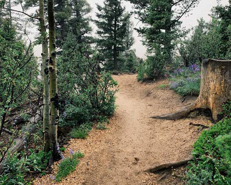
Take the Barr Trail Back Down
You made it! Take a moment to let the accomplishment sink in. You just climbed a mountain one railroad tie at a time. Grab photos, soak in the view, catch your breath.
Now here’s the important part: do not go back down the way you came up.
The Incline descent is treacherous — uneven steps, protruding spikes, wobbly and loose blocks. Plus, it’s brutal on your knees to descend at that angle after what you just put your body through.
Instead, take Barr Trail down. After what you just accomplished, this beautiful trail will feel like a reward. About 30 minutes into the descent, the downhill slope will provide enough challenge for your already-tired legs. Trust us on this one.
Pace yourself
Slow and steady wins this race. Start at a pace that feels almost embarrassingly slow — we’re talking tortoise-level commitment here. You’ll watch people sprint past you in the first few minutes, and that’s fine. They’ll be gasping at the false summit while you’re still moving. The Incline humbles everyone eventually, so save your energy for the long game.
Hydrate & Breathe
You’re going to sweat. A lot. Bring water — this is non-negotiable. Pace your drinking and make it last the entire climb.
Your breathing matters just as much as your hydration. You’re ascending 2,000 feet while exerting yourself at an expert level in thinner air. Monitor your breathing the entire way up. Finding a rhythm with your breath helps regulate oxygen intake, keeps you moving steadily, and distracts you from the fact that your legs are staging a protest.
Bailout Points
This trail means business, and altitude affects everyone differently. There’s zero shame in turning around — listen to your body. The Incline now has multiple return options:
-
At railroad tie 395: Connect to Ute Pass trail for a quick ⅓ mile back to the trailhead.
-
At railroad tie 1,300 (roughly halfway): Connect again to Ute Pass trail for a 1.5-mile hike back to the base.
-
About 500 steps beyond that: The original bailout point connects to Barr Trail.
Take a Break... or Two... or Six
Most people stop multiple times on the way up — there’s no prize for doing this without pausing. When you need a breather, try not to sit all the way down. Lean against the railing instead. This keeps your heart rate elevated enough that you don’t lose all your momentum when you start moving again.
And hey, while you’re catching your breath, turn around. The view keeps getting better with every step.
Beware the False Summit
Eventually, you’ll see what looks like the top. Your brain will start celebrating. Your legs will feel hopeful.
Bad news: that’s the false summit, and you’ve still got about 300 steps to go.
Good news: once you pass that point, the most challenging and dangerous stretch is behind you. You’re very, very close to the end.
Take the Barr Trail Back Down
You made it! Take a moment to let the accomplishment sink in. You just climbed a mountain one railroad tie at a time. Grab photos, soak in the view, catch your breath.
Now here’s the important part: do not go back down the way you came up.
The Incline descent is treacherous — uneven steps, protruding spikes, wobbly and loose blocks. Plus, it’s brutal on your knees to descend at that angle after what you just put your body through.
Instead, take Barr Trail down. After what you just accomplished, this beautiful trail will feel like a reward. About 30 minutes into the descent, the downhill slope will provide enough challenge for your already-tired legs. Trust us on this one.
FAQs
Where do I park for the Manitou Incline?
- For the closest parking, we recommend the Iron Springs Chateau Melodrama for $15. Online Reservations available here. 444 Ruxton Ave, Manitou Springs, CO 80829
- For only $1.75-2.50/hour, park and take the shuttle at Hiawatha Gardens Parking Lot located at 10 Old Man’s Trail
What should I wear?
Sturdy shoes and breathable athletic wear. Make sure to wear sunscreen and pack plenty of water!
How long does it take to do the hike?
It takes the average person 2 hours to hike up the Incline.
Where do I make reservations?
You can make a free reservation at coloradosprings.gov/incline
Can I bring my dog?
No pets are allowed on the trail.
What are the hours?
6 a.m. – 6:30 p.m. daily
Your resource
Explore. Discover. Plan.
Thinking about visiting the Pikes Peak Region but not sure where to start? We’re here to make the planning process easier.
Order a free guide
If you’re ready to start planning your ultimate adventure, there’s no better place to start than our free Vacation Planner.
Email Us
This goes to our whole team of locals, available M-F from 8-5 MST. Send us your questions, we’re happy to help!
Helpful resources
Dig a little deeper into your research with these great online resources. We’ve compiled this quick list of our most visited pages on the website.